Prioritizing sites as potential Research Natural Areas to represent a set of target vegetation types is a complex planning problem in which competing objectives must be satisfied simultaneously, including suitability (i.e., choosing the most ecologically appropriate sites) and efficiency (i.e, covering the most types with the least sites). For a project funded by the U. S. Forest Service, we have developed a general process for identifying and siting potential Research Natural Areas that is based on a systematic description of vegetation and environmental variation in the region, analysis of patterns of vegetation ownership and management, optimal site selection based both on vegetational and environmental criteria, and ground truthing of the initial selection of sites.
Our proposed protocol follows a sequence of five steps:
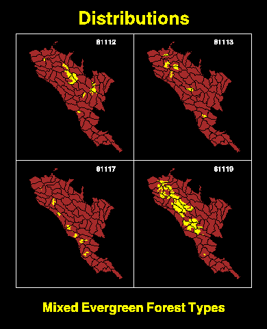
1. Vegetation Target Type Identification: Identify the subset of target vegetation types to be represented in RNAs (classification of GIS attribute data and GIS overlay).
2. Quantification of Environmental Variation: Characterize typical environment within the target types (GIS overlay and summary statistics).
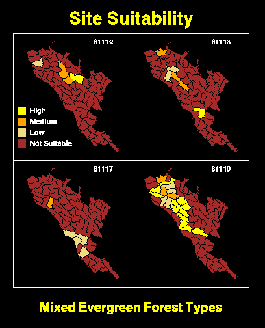
3. Calculation of Site Suitability: Characterize the suitability of sites to represent each target type (GIS modeling).
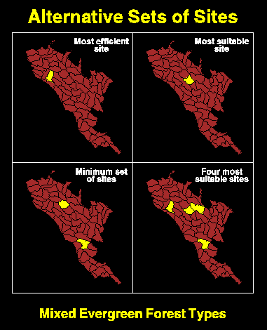
4. Site Selection: Apply a siting model to identify the most efficient and/or suitable set of sites (linear programming model plus GIS for visualization).
5. Ground Truth: Evaluate the best sites in the field.
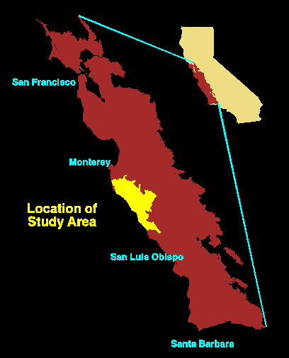
The approach is demonstrated with an application to siting Research Natural Areas on the Monterey Ranger District of Los Padres National Forest in the central coast of California. The case study was limited to Mixed Evergreen Forest types. They were classified and mapped using data from the California Gap Analysis project. The suitability of all sites (i.e., planning watersheds) in the study area was evaluated based on the extent of Mixed Evergreen Forest at the site and the representativeness of the site for each type. The latter criteria was derived from the position of the site in the environmental gradients that are correlated with each type. In the case study, the elevational gradient was used as a surrogate for climatic variables. A weighted-benefits Maximal Covering Location Model, similar to a previous model described in Church et al. (1996) was used to select sites in a set of alternatives that varied in the number of sites that were chosen and in the balance between efficiency and suitability.
We envision this process as a prototype that could be adopted by the Forest Service as a preliminary step that would precede more detailed ground survey and administrative review procedures as currently practiced. It could also be adapted to similar programs of regional conservation planning.
For more details on the proposed protocol and the case study, please see the on-line paper that was presented at the 17th Annual ESRI Users Conference, July 1997.
And an article has just been published in the Natural Areas Journal.
Frank W. Davis
USDA Forest Service
January, 1997 to December, 1997
Completed