
UCSB IBM ERP Related
Publications Abstracts
A Spatial Analytical
Hierarchy for Gap Analysis
Frank W. Davis
and David M. Stoms
Representation
in the nature reserve system is determined by comparing the distribution
of vegetation and vertebrates with that of land ownership and management
over a region of interest. Locating potential places to increase representation
is typically done by a systematic selection algorithm over a set of
spatial units larger than the landscape units of the vegetation map.
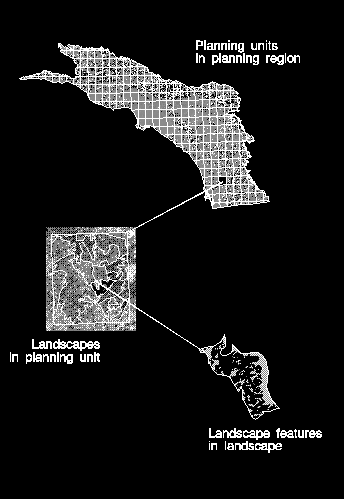
The landscape is thus the basic spatial unit at which biodiversity
data are compiled for Gap Analysis. However, it is only one of four
levels of spatial entity that must be explicitly defined in order
to complete a Gap Analysis. We refer to these entities as the planning
region, the planning unit, the landscape, and the landscape feature
(see figure). The objective of
this paper is to describe a spatial analytical hierarchy for Gap Analysis
based on these four entities. Within this broader theme we also present
results of a more focused analysis on the effect of planning unit
size on the selection of priority conservation areas in southwestern
California.
|

