

What's New
Research & Projects Publications
People
Data
Links
California Gap Analysis Project: Regional Datasets
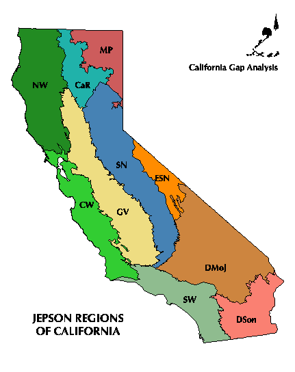
This page lists the regional spatial datasets available online from the California Gap Analysis Project. The land-cover data layer was compiled and used in the actual analysis, but the Thematic Mapper served as base map information. The TM imagery is provided in compressed files for both Unix and winzip compression formats. The regions are based on the physiographic regions described for the Jepson flora of California.
Click the META icons to view or download the data documentation.
Click the EXPORT icons with the RIGHT mouse button and select "Save Link As" to download ARC/INFO export files or image files.
Region Region Name Land Cover Thematic Mapper (Unix version) Thematic Mapper (Windows version)
Metadata
NW Northwestern California CaR Cascade Ranges MP Modoc Plateau CW Central Western California GV Great Central Valley SN Sierra Nevada ESN East of the Sierra Nevada SW Southwestern California DMoj Mojave Desert DSon Sonoran Desert
CA-GAP Home | Overview | Report | Download GIS | CD-ROM | Site Index | National GAP
Top of Page Send your comments stoms@bren.ucsb.edu
UCSB Biogeography Lab Home
