Table of Contents
Identification Information
Data Quality Information
Spatial Data Organization Information
Spatial Reference Information
Entity and Attribute Information
Distribution Information
Metadata Reference Information
Contact Information
Data Set Identity: county
Description:
This is a coverage of the county boundaries of California. The lines were extracted from U.S. Census TIGER/line files using an AML program written by Doug Nebert and Mark Negri, running on two Data General 6220 servers. The coverage that was obtained from USGS was reprojected into Albers equal area projection and clipped to the coastline of the state, rather than the three-mile limit used in the TIGER files. This coverage is intended as a basemap for any desired GIS application.
Supplemental Information: n/a
Data Set Status: in use
West Bounding Coordinate: -124.5048
East Bounding Coordinate: -114.2648
North Bounding Coordinate: 41.9886
South Bounding Coordinate: 32.4234
Theme Keyword: County boundaries, Political Units
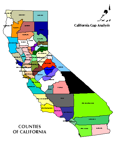
Browse Graphic File Name: county.gif
Browse Graphic File Description: Graphic of the counties of
California.
Browse Graphic File Type: GIF
Use Restrictions: None
Access Limitations:
There are no restrictions of access to this dataset.
Native Data Set Environment:
ARC/INFO software version 7.0.3 running on IBM RS6000 with AIX 3.2.5
Raster File Format: n/a
Raster File Sensor: n/a
Vector File Format: ARCE7 (ARC/INFO Export format, version 7)
Nonspatial File Format: n/a
Attribute Accuracy: 100%
Attribute Accuracy Explanation:
Proof-reading of data attributes against other maps by USGS.
Logical Consistency Report:
Each attribute label was confirmed to be a member of the set of valid values, and each map unit has one and only one label.
Completeness Report:
The entire state (except for the offshore islands) is included.
Horizontal Positional Accuracy: unknown
Horizontal Positional Accuracy Explanation: n/a
Vertical Positional Accuracy: n/a
Vertical Positional Accuracy Explanation: n/a
Source Information:
The data were extracted from the 1990 Precensus TIGER files stored on CD-ROM.
Source Date: 1990
Source Distance Resolution: n/a
Process Description:
The data were run through ARCTIGER.AML at USGS. At UCSB, the coverage was reprojected into Albers equal area projection and clipped by a 1:100,000 scale map of the coastline and state boundary derived from the statewide land ownership map.
Native Data Structure: spatial vector
Raster File Row (Line) Count: n/a
Raster File Column (Sample) Count: n/a
Raster File Vertical (Band) Count: n/a
Raster File Number of Bytes per Pixel: n/a
Geographic Coordinate Units: Degrees, minutes and decimal seconds
Map Projection Name: Albers Conical Equal Area
Map Projection Description:
Projection ALBERS
Units METERS
Spheroid CLARKE1866
Parameters:
Distance Resolution (meters): n/a
Altitude Resolution (meters): n/a
  Entity_Type:
    Entity_Type_label:  COUNTY100.PAT
    Entity_Type_Definition:  Polygon attribute table
    Attribute:
      Attribute_Label:  COUNTY100-ID
      Attribute_Definition:  User-assigned feature number
      Attribute_Definition_Source:  User-defined
      Attribute_Domain_Values:  Integer
    Attribute:
      Attribute_Label:  STATECTY
      Attribute_Definition:  State/county code
      Attribute_Definition_Source:  Federal Information Processing Standard
      Attribute_Domain_Values:  06001-06115
    Attribute:
      Attribute_Label:  ST
      Attribute_Definition:  State abbreviation
      Attribute_Definition_Source:  U.S. Postal Service
      Attribute_Domain_Values:  CA
    Attribute:
      Attribute_Label:  CNTYNAME
      Attribute_Definition:  County name
      Attribute_Definition_Source:  U.S. Geological Survey files
      Attribute_Domain_Values:  Upper-case alphanumeric
    Attribute:
      Attribute_Label:  POLYTYPE
      Attribute_Definition:  Polygon type
      Attribute_Definition_Source:  This item is not populated.
      Attribute_Domain_Values:  0
    Attribute:
      Attribute_Label:  FIPS:ST
      Attribute_Definition:  Standard 2-digit FIPS State code
      Attribute_Definition_Source:  Federal Information Processing Standard
      Attribute_Domain_Values:  06
    Attribute:
      Attribute_Label:  FIPS:CO
      Attribute_Definition:  Standard 3-digit FIPS County code
      Attribute_Definition_Source:  Federal Information Processing Standard
      Attribute_Domain_Values:  001 - 115
    Attribute:
      Attribute_Label:  FIPS
      Attribute_Definition:  Standard 5-digit FIPS code
      Attribute_Definition_Source:  Federal Information Processing Standard
      Attribute_Domain_Values:  06001-06115
Entity and Attribute Detail Citation:
Each county is identified by a 5-digit STATECTY code derived from the Federal Information Processing Standard (FIPS) code. The first 2 digits represent the state and the remaining 3 digits represent the county within that state.
Distributor:
phone: 805-893-3438
fax: 805-893-3146
e-mail: fd@geog.ucsb.edu
ftp address:
ftp://ftp.biogeog.ucsb.edu/pub/org/biogeog/data/gap_analysis
URL:
http://www.biogeog.ucsb.edu/projects/gap/gap_data.html
Distribution Liability:
The University of California assumes no responsibility for application of the data beyond their original intent.
Standard Order Process:
Data are available through anonymous ftp and the World Wide Web at the ftp address and URL address listed under Distributor.
File Decompression Technique: None
Transfer Size: 1.0 Mb in gzip compressed format; 4.5 Mb uncompressed
Metadata Date: 07/15/98
Metadata Standard Name: Metadata Standards for Gap Analysis
Metadata Standard Version: 09/05/94
Metadata Review Date: 12/13/96
Metadata Contact:
Contact Person Primary: Dr. David Stoms
Contact Mail Address:
Contact Voice Telephone: (805) 893-7655
Contact Facsimile Telephone: (805) 893-3146
Contact Electronic Mail Address:
stoms@geog.ucsb.edu