

What's New
Research & Projects Publications
People
Data
Links
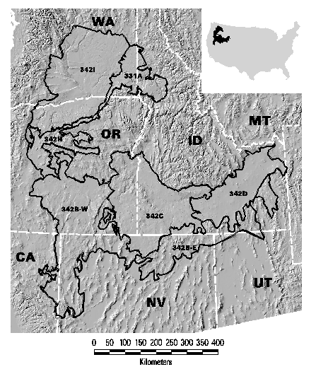
PRESERVE SELECTION MODELING IN THE COLUMBIA PLATEAU
EXECUTIVE SUMMARY
TNC contracted the UCSB Biogeography Lab to assist in developing a prototype conservation planning process for the Columbia Plateau ecoregion. The prototype was to integrate the spatial analysis functions of a geographic information system (GIS) with an optimization model for designing alternative portfolios. TNC identified three questions to be explored through this prototype planning process:
- What set of site selection rules provides the most efficient method for designing and assembling a portfolio of sites to maintain all viable native species and community types within a target ecoregion (i.e., how can TNC maximize the amount of biodiversity protected relative to the given number of conservation sites or amount of land area)?
- How sensitive is the portfolio to the way in which biodiversity is measured (e.g., what are the effects of using a coarse-filter (alliances from Gap Analysis) or fine-filter (rare element occurrences for species and plant community associations from Natural Heritage programs)?
- How can TNC integrate programmatic, economic and socio-political factors into the portfolio design process without sacrificing its biodiversity goals?
The planning process is outlined in graphic form in seven steps. The first step was for the TNC planning team to select initial conservation goals, objectives, and targets as a set of preliminary decision rule. In step 2, the spatial data for the distribution of biodiversity elements is summarized to determine which are already represented at or above the predetermined goals of the alternative and which are still vulnerable. For those that are underrepresented, the third step is to quantify the area that is not currently protected for each element in each planning unit. This task identifies the set of planning units that are available to meet the representation goals. Step 4 calculates a suitability index for each planning unit based on precomputed attributes and a set of weights selected for each alternative. These three steps are performed within a GIS, and the results are exported to an external optimal site selection model at step 5. The reserve selection model originally developed for the Sierra Nevada Ecosystem Project was adapted to the task of selecting sites to achieve alternative conservation strategies in the Columbia Plateau ecoregion. This model selects a set of planning units that satisfies the representation goals with the best balance of efficiency (least area) and suitability (best quality or most manageable sites). Data generated by the model is returned to the GIS environment for further analysis and visualization. The process can be repeated to test the sensitivity to different parameters such as the choice of goals or the suitability factors. TNC then used the results of the analysis to evaluate the set of sites of the preferred alternative and adjusted the set of sites to design their recommended portfolio as the final step.
By modifying the set of conservation targets, a number of alternative portfolios were generated including for the land-cover types alone (coarse-filter), rare elements alone (fine-filter), and both cover types and rare elements together (integrated coarse- and fine-filters). Managed areas in categories I and II were assumed to be protected in all alternatives. All subwatersheds identified by at least four of the six expert panels were automatically included in every alternative as core areas. Thus for each alternative, there were three types of site in the portfolio: existing reserves, core areas from the experts, and additional subwatersheds selected in the BMAS model to achieve the representation targets. An additional 185 subwatersheds were selected to achieve the representation goals for the coarse-filter alternative, basically doubling the total area of existing BMAs and core areas. Representing the 359 fine-filter rare species and plant associations that are vulnerable required 501 additional subwatersheds because the locations of these target elements tend to be widely scattered. The integrated coarse- and fine-filter alternative found some efficiencies in representing the 481 vulnerable elements simultaneously in 567 subwatersheds. Representing rare elements does not leave much flexibility without selecting very low suitability sites. In fact, 273 of the 359 rare target elements occur at no more sites than required by the representation goals. Thus all their occurrences had to be selected, making 321 of the 567 subwatersheds "irreplaceable."
The major purposes of a pilot study such as this are to learn the advantages and limitations of the process, to recommend actions for implementation of the prototype on a wider basis, and to identify future research needs revealed by the study. Specifically we recommend:
- TNC use the expert opinion method to identify a set of core areas that must be protected in any portfolio, followed by the BMAS, or related, model to select additional planning units as needed to meet the representation goals.
- The set of planning units selected by the model should not be accepted on faith as an ideal portfolio. The model solution only forms a starting point of a portfolio. The planning team must still apply their own intimate knowledge of specific sites to refine the portfolio, using personal knowledge not explicitly in the GIS database nor incorporated in the BMAS model.
- The cartographic representation of the set of selected planning units (i.e., subwatersheds) is not a map of the precise boundaries of conservation sites. The set of planning units merely indicates general locations where appropriate management strategies can be applied. Displaying a portfolio from this prototype planning process as a set of large planning units risks overstating the magnitude of the conservation agenda and alarming other stakeholders. We strongly urge caution in how TNC publicly portrays any portfolio derived in part by BMAS modeling based on subwatersheds or other such planning units.
- TNC undertake additional pilot studies in ecoregions across a range of management situations, including more highly altered landscapes in the eastern half of the nation.
- TNC should conduct or sponsor research to address three issues we consider central to ecoregion-based conservation, namely: 1) development of approaches and techniques for assessing species and community-level viability under a particular conservation scenario, 2) development of improved, multi-objective models for identifying the best set of sites within a region for meeting the stated conservation goal while addressing viability and spatial configuration, and 3) testing of regional viability measures and siting solutions against more detailed information on biotic composition and ecosystem processes to establish the relationship between regional and local conservation measures and approaches.
Return to Table of Contents