A SPATIAL MODELING AND DECISION SUPPORT SYSTEM FOR CONSERVATION OF BIOLOGICAL DIVERSITY
During the past decade there has been a pronounced shift in natural resource management and conservation away from piecemeal action on single species or localities towards integrated analysis of multi-species communities, habitats, and human social and economic systems over large planning areas. There are many scientific, institutional and technological barriers to implementing such "bioregional" planning and ecosystem management. Efforts in California and elsewhere have been hampered by inadequate ecological theory, by the lack of reliable geospatial data on species and habitats, and by the sometimes insurmountable problems encountered in trying to piece together existing data and information from different agencies and organizations. These problems, which we have encountered many times in conducting our Gap Analysis of California, only worsen as one tries to bring together biological and environmental data and models for several states to conduct a regional assessment such as our IBM supported Gap Analysis of the Intermountain Semi-Desert Ecoregion.
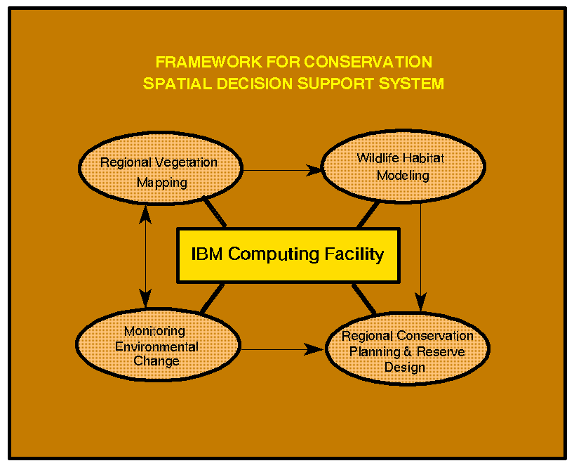
The next sections of the report provide additional detail on scientific progress in three of the four scientific areas shown in Figure 3: regional vegetation classification and mapping, wildlife habitat modeling, and regional conservation planning and reserve design.
Regional vegetation classification and mapping
Wildlife habitat modeling
Regional conservation planning and reserve design